Category:Ashby Woulds
Jump to navigation
Jump to search
village and civil parish in Leicestershire, England, UK | |||||
| Upload media | |||||
| Instance of | |||||
|---|---|---|---|---|---|
| Location | North West Leicestershire, Leicestershire, East Midlands, England | ||||
 | |||||
English: Ashby Woulds is a civil parish in Leicestershire, England. It is in the North West Leicestershire district, to the west of Ashby de la Zouch. The main settlements in the parish are Norris Hill and Moira.

Subcategories
This category has the following 4 subcategories, out of 4 total.
Media in category "Ashby Woulds"
The following 108 files are in this category, out of 108 total.
-
 'Heart of the Forest, Moira Junction South' - geograph.org.uk - 6081307.jpg 3,776 × 2,520; 3.17 MB
-
 Albert Village - geograph.org.uk - 5566133.jpg 2,000 × 1,333; 1.69 MB
-
 Albert Village - geograph.org.uk - 5566139.jpg 2,000 × 1,333; 1.55 MB
-
 Albert Village Lake - geograph.org.uk - 4144813.jpg 1,600 × 1,067; 412 KB
-
 Allotments at Albert Village - geograph.org.uk - 4145068.jpg 1,600 × 1,065; 539 KB
-
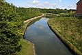
 Ashby Canal - geograph.org.uk - 3165932.jpg 640 × 424; 264 KB
-
 Ashby Canal - geograph.org.uk - 3165937.jpg 424 × 640; 234 KB
-
 Ashby Canal - geograph.org.uk - 3165940.jpg 424 × 640; 227 KB
-
 Ashby Canal - geograph.org.uk - 3165970.jpg 424 × 640; 274 KB
-
 Ashby Canal - geograph.org.uk - 3165989.jpg 640 × 424; 216 KB
-
 Ashby Canal - geograph.org.uk - 4144767.jpg 1,600 × 1,067; 308 KB
-
 Ashby Canal at Ashby Woulds, Leicestershire.jpg 640 × 480; 103 KB
-
 Ashby Canal at Moira - geograph.org.uk - 4145151.jpg 1,600 × 1,068; 459 KB
-
 Ashby Canal at Moira - geograph.org.uk - 4145152.jpg 1,600 × 1,066; 533 KB
-
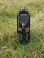 Ashby Canal Mine Seam Marker - geograph.org.uk - 4144780.jpg 1,200 × 1,600; 792 KB
-
 Ashby Canal, Moira - geograph.org.uk - 4034790.jpg 1,280 × 960; 190 KB
-
 Ashby Woulds Heritage Trail - geograph.org.uk - 797839.jpg 640 × 475; 139 KB
-
 Ashby Woulds Heritage Trail - geograph.org.uk - 797885.jpg 640 × 545; 157 KB
-
-
 Birdlife on the Lake, Albert Village - geograph.org.uk - 4648735.jpg 4,000 × 3,000; 3.18 MB
-
 Centenary Methodist Church, Moira - geograph.org.uk - 6202129.jpg 800 × 530; 78 KB
-
 Children's playground by Occupation Road - geograph.org.uk - 4145073.jpg 1,600 × 1,069; 552 KB
-
 Conkers Discovery Centre - geograph.org.uk - 2065297.jpg 640 × 384; 73 KB
-
 Construction work for new housing - geograph.org.uk - 4145226.jpg 1,600 × 1,070; 418 KB
-
 Cycle path through new woodland towards the cafe - geograph.org.uk - 4145344.jpg 1,600 × 1,068; 379 KB
-
-
 Cycle Route 63 heading north-west towards Swadlincote - geograph.org.uk - 6081281.jpg 3,776 × 2,520; 4.09 MB
-

-
 Donisthorpe Canal Terminus - geograph.org.uk - 2064608.jpg 640 × 355; 56 KB
-
 Donisthorpe Colliery cage - geograph.org.uk - 3165942.jpg 640 × 424; 334 KB
-
 Dwellings and Waste Ground at Spring Cottage - geograph.org.uk - 4648746.jpg 4,000 × 3,000; 2.73 MB
-
 Engine House Cottage - geograph.org.uk - 4034797.jpg 946 × 1,280; 469 KB
-
 Entrance to Gresley Wood - geograph.org.uk - 6080421.jpg 3,776 × 2,520; 4.04 MB
-
 Entrance to The Dumbles - geograph.org.uk - 4145355.jpg 1,600 × 1,073; 513 KB
-
 Fire^ Rubbish^ - geograph.org.uk - 307619.jpg 640 × 480; 78 KB
-
 Footbridge over the Ashby Canal - geograph.org.uk - 5197932.jpg 2,000 × 1,500; 290 KB
-
 Footpath into Woodville - geograph.org.uk - 4145422.jpg 1,600 × 1,068; 469 KB
-
 Footpath off Gorse Lane - geograph.org.uk - 4145183.jpg 1,200 × 1,600; 744 KB
-
 Footpath to Boothorpe - geograph.org.uk - 4145214.jpg 1,600 × 1,068; 583 KB
-
 Footpath to Boothorpe Lane - geograph.org.uk - 4145383.jpg 1,600 × 1,066; 355 KB
-
 Footpath to Church Gresley - geograph.org.uk - 4144811.jpg 1,600 × 1,067; 593 KB
-
 Footpath to Hepworth Road - geograph.org.uk - 4145229.jpg 1,200 × 1,600; 748 KB
-
 Footpath to Swainspark - geograph.org.uk - 4144770.jpg 1,600 × 1,069; 610 KB
-
 Footpath to Woodville - geograph.org.uk - 4145375.jpg 1,600 × 1,068; 608 KB
-
 Footpath to Woodville - geograph.org.uk - 4145389.jpg 1,200 × 1,600; 655 KB
-
 Footpath towards Boothorpe - geograph.org.uk - 4145194.jpg 1,600 × 1,067; 735 KB
-
 Former playground near Devon Close - geograph.org.uk - 2471045.jpg 640 × 480; 119 KB
-
 Former tramways - Moira - geograph.org.uk - 3165949.jpg 640 × 424; 273 KB
-
 Gorse Lane - geograph.org.uk - 4145167.jpg 1,200 × 1,600; 735 KB
-
 Gorse Lane - geograph.org.uk - 4145169.jpg 1,600 × 1,067; 677 KB
-
 Hilltop Wood near Boothorpe - geograph.org.uk - 4145188.jpg 1,600 × 1,068; 626 KB
-
 Houses on Measham Road, Moira - geograph.org.uk - 6202123.jpg 800 × 506; 73 KB
-
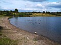
 Large pond at Hicks Lodge - 1 - geograph.org.uk - 1503294.jpg 640 × 480; 122 KB
-
 Large pond at Hicks Lodge - 2 - geograph.org.uk - 1503333.jpg 640 × 480; 114 KB
-
 Large pond at Hicks Lodge - 3 - geograph.org.uk - 1503350.jpg 640 × 480; 105 KB
-
 Limekilns at Moira Furnace - geograph.org.uk - 4034793.jpg 1,280 × 960; 315 KB
-
 Line Kilns, Moira Furnace - geograph.org.uk - 4789121.jpg 1,600 × 1,067; 390 KB
-
 Line to Ashby - geograph.org.uk - 1502951.jpg 640 × 480; 132 KB
-
 Locks at Moira - geograph.org.uk - 4145149.jpg 1,600 × 1,068; 366 KB
-
 Lodges by the canal - geograph.org.uk - 4144781.jpg 1,600 × 1,068; 405 KB
-
 Love Heart Lake at Hick's Lodge - geograph.org.uk - 6359615.jpg 1,024 × 768; 216 KB
-
 Measham Road, Moira - geograph.org.uk - 6202125.jpg 800 × 600; 119 KB
-
 Moira - Limekilns - geograph.org.uk - 3165950.jpg 640 × 424; 285 KB
-
 Moira - Limekilns - geograph.org.uk - 3165966.jpg 640 × 424; 289 KB
-
 Moira Furnace - geograph.org.uk - 3165925.jpg 640 × 424; 260 KB
-
 Moira Furnace - geograph.org.uk - 3165929.jpg 424 × 640; 290 KB
-
 Moira Furnace - geograph.org.uk - 3165931.jpg 640 × 424; 264 KB
-
 Moira Furnace - geograph.org.uk - 3165933.jpg 640 × 420; 260 KB
-
 Moira Furnace - geograph.org.uk - 3165935.jpg 424 × 640; 263 KB
-
 Moira Furnace - geograph.org.uk - 3165944.jpg 640 × 424; 259 KB
-
 Moira Furnace - geograph.org.uk - 3165948.jpg 424 × 640; 276 KB
-
 Moira Furnace - geograph.org.uk - 3166003.jpg 640 × 424; 268 KB
-
 Moira Furnace - geograph.org.uk - 4683209.jpg 1,280 × 960; 432 KB
-
 Moira Furnace and the canal - geograph.org.uk - 4778272.jpg 1,600 × 1,067; 354 KB
-
 Moira Terminus Basin - geograph.org.uk - 2065301.jpg 640 × 355; 50 KB
-
 Moira West Junction Signal Box - geograph.org.uk - 2618275.jpg 3,301 × 2,341; 1.92 MB
-
 Navigation Inn - geograph.org.uk - 4144800.jpg 1,600 × 1,068; 281 KB
-
 New build at edge of Newfield and Hick's Lodge - geograph.org.uk - 6359623.jpg 1,024 × 768; 139 KB
-
 New houses on Davenport Way - geograph.org.uk - 4145222.jpg 1,600 × 1,068; 325 KB
-
 New planting at Hicks Lodge - 2 - geograph.org.uk - 1503078.jpg 640 × 480; 143 KB
-
 New woodland by Gorse Lane - geograph.org.uk - 4145174.jpg 1,600 × 1,068; 544 KB
-
 On the National Forest Way - Gorse Ln nearing Boothorpe - geograph.org.uk - 5617241.jpg 5,184 × 2,920; 4.8 MB
-
 Park Road, Moira - geograph.org.uk - 4034779.jpg 1,280 × 866; 309 KB
-
 Path by the canal - geograph.org.uk - 4144775.jpg 1,600 × 1,067; 555 KB
-
 Path near Hill Farm - geograph.org.uk - 1502898.jpg 640 × 480; 97 KB
-
 Path onto Hepworth Road - geograph.org.uk - 4145401.jpg 1,600 × 1,067; 593 KB
-
 Path out of the locked car park - geograph.org.uk - 4145159.jpg 1,600 × 1,067; 657 KB
-
 Path to Swainspark - geograph.org.uk - 4144688.jpg 1,600 × 1,068; 625 KB
-
 Powerlines across the field - geograph.org.uk - 4145410.jpg 1,600 × 1,068; 339 KB
-
 Radagal Bridge - geograph.org.uk - 2065308.jpg 640 × 399; 98 KB
-
 Railway line to Burton - geograph.org.uk - 4144691.jpg 1,600 × 1,067; 621 KB
-
 Road into Shell Brook Wood - geograph.org.uk - 4145332.jpg 1,600 × 1,068; 407 KB
-
 Sculpture by the path to the lake - geograph.org.uk - 4144816.jpg 1,600 × 1,067; 606 KB
-
 Shortheath Road, Moira - geograph.org.uk - 6203787.jpg 800 × 528; 79 KB
-
 Sign for the Rawdon Arms, Moira - geograph.org.uk - 6202135.jpg 576 × 800; 65 KB
-
 Straw bales near Bramborough Farm - geograph.org.uk - 1502585.jpg 640 × 480; 107 KB
-
 Stubble field near Bramborough Farm - geograph.org.uk - 1502525.jpg 640 × 480; 152 KB
-
 Swing Bridge Moira Furnace - geograph.org.uk - 2065289.jpg 640 × 355; 78 KB
-

-
 The Ashby Woulds - geograph.org.uk - 4708363.jpg 1,280 × 960; 312 KB
-
 The Lake at Albert Village - geograph.org.uk - 4648728.jpg 4,000 × 3,000; 2.21 MB
-
 The Rawdon Arms, Moira - geograph.org.uk - 6202134.jpg 640 × 519; 68 KB
-
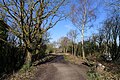
 Track into conservation area - geograph.org.uk - 4145347.jpg 1,600 × 1,067; 474 KB
-
 Track near Swainspark - geograph.org.uk - 3171625.jpg 4,000 × 3,000; 2.98 MB
-
 War Memorial, Moira - geograph.org.uk - 6203791.jpg 727 × 800; 109 KB
-
 Willesley Lane - geograph.org.uk - 1503002.jpg 640 × 480; 118 KB
-
 Angular - geograph.org.uk - 557711.jpg 640 × 480; 73 KB
-
 Part of the famous T G Green Factory - geograph.org.uk - 28040.jpg 640 × 480; 81 KB


